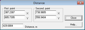
Allows measuring distances on the map. Use this tool to draw a line on the map and to obtain its length, or input coordinates to calculate distance the between them. When you open the dialog window "Distance", you see a straight line that can be moved by clicking either the left- or right mouse button. X and Y fields indicate the coordinates of the both ends of the distance line.
|
– button “Distance” in the Toolbar menu. |
ALT |
Measures distance in the X-direction |
CTRL |
Measures distance in the Y-direction |